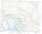
Maps showing Bashaw, 4-42-21-W4, Alberta
Bashaw is a Town located in 4-42-21-W4, Alberta and has an elevation of 792 meters.
- Latitude: 52° 34' 59'' North (decimal: 52.5830555)
- Longitude: 112° 58' 13'' West (decimal: -112.9702777)
- Topography Feature Category: Town
- Geographical Feature: Town
- Canadian Province/Territory: Alberta
- Elevation: 792 meters
- Location: 4-42-21-W4
- Atlas of Canada Locator Map: Bashaw
- GPS Coordinate Locator Map: Bashaw Lat/Long