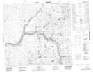
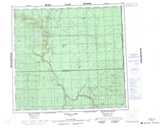
Maps showing Bad Rapids, 93-4,5-W5, Alberta
Bad Rapids is a Rapids located in 93-4,5-W5, Alberta and has an elevation of 466 meters.
- Latitude: 57° 5' 38'' North (decimal: 57.0938888)
- Longitude: 114° 38' 24'' West (decimal: -114.6399999)
- Topography Feature Category: Rapids
- Geographical Feature: Rapids
- Canadian Province/Territory: Alberta
- Elevation: 466 meters
- Location: 93-4,5-W5
- Atlas of Canada Locator Map: Bad Rapids
- GPS Coordinate Locator Map: Bad Rapids Lat/Long
Bad Rapids NTS Map Sheets