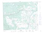
Maps showing Bearberry Prairie, 32-6-W5, Alberta
Bearberry Prairie is a Low vegetation located in 32-6-W5, Alberta and has an elevation of 1153 meters.
- Latitude: 51° 46' 45'' North (decimal: 51.7791666)
- Longitude: 114° 46' 31'' West (decimal: -114.7752778)
- Topography Feature Category: Low vegetation
- Geographical Feature: Prairie
- Canadian Province/Territory: Alberta
- Elevation: 1153 meters
- Location: 32-6-W5
- Atlas of Canada Locator Map: Bearberry Prairie
- GPS Coordinate Locator Map: Bearberry Prairie Lat/Long