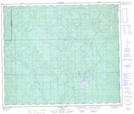
Maps showing Bear Creek, 62-14-W5, Alberta
Bear Creek is a River located in 62-14-W5, Alberta and has an elevation of 929 meters.
- Latitude: 54° 22' North (decimal: 54.3666667)
- Longitude: 115° 59' West (decimal: -115.9833333)
- Topography Feature Category: River
- Geographical Feature: Creek
- Canadian Province/Territory: Alberta
- Elevation: 929 meters
- Location: 62-14-W5
- Atlas of Canada Locator Map: Bear Creek
- GPS Coordinate Locator Map: Bear Creek Lat/Long
Bear Creek NTS Map Sheets