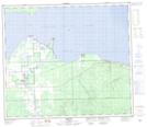
Maps showing Prichuk Hill, 24-73-9-W5, Alberta
Prichuk Hill is a Mountain located in 24-73-9-W5, Alberta.
- Latitude: 55° 20' 26'' North (decimal: 55.3405555)
- Longitude: 115° 14' 45'' West (decimal: -115.2458333)
- Topography Feature Category: Mountain
- Geographical Feature: Hill
- Canadian Province/Territory: Alberta
- Location: 24-73-9-W5
- Atlas of Canada Locator Map: Prichuk Hill
- GPS Coordinate Locator Map: Prichuk Hill Lat/Long
Prichuk Hill NTS Map Sheets