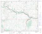
Maps showing Prospect Valley, 45-2,3-W4, Alberta
Prospect Valley is a Unincorporated area located in 45-2,3-W4, Alberta.
- Latitude: 52° 51' 30'' North (decimal: 52.8583333)
- Longitude: 110° 17' 25'' West (decimal: -110.2902778)
- Topography Feature Category: Unincorporated area
- Geographical Feature: Locality
- Canadian Province/Territory: Alberta
- Location: 45-2,3-W4
- Atlas of Canada Locator Map: Prospect Valley
- GPS Coordinate Locator Map: Prospect Valley Lat/Long
Prospect Valley NTS Map Sheets