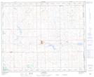
Maps showing Provost, 17-39-2-W4, Alberta
Provost is a Town located in 17-39-2-W4, Alberta and has an elevation of 681 meters.
- Latitude: 52° 21' 12'' North (decimal: 52.3533333)
- Longitude: 110° 15' 53'' West (decimal: -110.2647222)
- Topography Feature Category: Town
- Geographical Feature: Town
- Canadian Province/Territory: Alberta
- Elevation: 681 meters
- Location: 17-39-2-W4
- Atlas of Canada Locator Map: Provost
- GPS Coordinate Locator Map: Provost Lat/Long