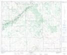
Maps showing Puffer, 22-39-10-W4, Alberta
Puffer is a Unincorporated area located in 22-39-10-W4, Alberta and has an elevation of 755 meters.
- Latitude: 52° 22' 35'' North (decimal: 52.3763889)
- Longitude: 111° 22' 27'' West (decimal: -111.3741666)
- Topography Feature Category: Unincorporated area
- Geographical Feature: Locality
- Canadian Province/Territory: Alberta
- Elevation: 755 meters
- Location: 22-39-10-W4
- Atlas of Canada Locator Map: Puffer
- GPS Coordinate Locator Map: Puffer Lat/Long
Puffer NTS Map Sheets