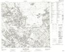
Maps showing Purdy Lake, 109-3-W4, Alberta
Purdy Lake is a Lake located in 109-3-W4, Alberta.
- Latitude: 58° 25' 49'' North (decimal: 58.4302778)
- Longitude: 110° 25' 31'' West (decimal: -110.4252778)
- Topography Feature Category: Lake
- Geographical Feature: Lake
- Canadian Province/Territory: Alberta
- Location: 109-3-W4
- Atlas of Canada Locator Map: Purdy Lake
- GPS Coordinate Locator Map: Purdy Lake Lat/Long
Purdy Lake NTS Map Sheets