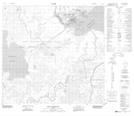
Maps showing Quatre Fourches, 21-111-8-W4, Alberta
Quatre Fourches is a Unincorporated area located in 21-111-8-W4, Alberta and has an elevation of 217 meters.
- Latitude: 58° 38' 8'' North (decimal: 58.6355555)
- Longitude: 111° 18' 50'' West (decimal: -111.3138889)
- Topography Feature Category: Unincorporated area
- Geographical Feature: Locality
- Canadian Province/Territory: Alberta
- Elevation: 217 meters
- Location: 21-111-8-W4
- Atlas of Canada Locator Map: Quatre Fourches
- GPS Coordinate Locator Map: Quatre Fourches Lat/Long
Quatre Fourches NTS Map Sheets