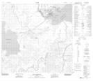
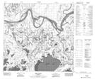
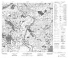
Maps showing Chenal des Quatre Fourches, 112,113-9-W4, Alberta
Chenal des Quatre Fourches is a Channel located in 112,113-9-W4, Alberta and has an elevation of 217 meters.
- Latitude: 58° 53' 27'' North (decimal: 58.8908329)
- Longitude: 111° 36' 7'' West (decimal: -111.6019170)
- Topography Feature Category: Channel
- Geographical Feature: Chenal
- Canadian Province/Territory: Alberta
- Elevation: 217 meters
- Location: 112,113-9-W4
- Atlas of Canada Locator Map: Chenal des Quatre Fourches
- GPS Coordinate Locator Map: Chenal des Quatre Fourches Lat/Long
Chenal des Quatre Fourches NTS Map Sheets