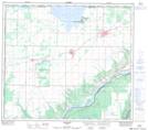
Maps showing Queen Elizabeth Provincial Park, Lac Cardinal, 83-24-W5, Alberta
Queen Elizabeth Provincial Park, Lac Cardinal is a Conservation area located in 83-24-W5, Alberta and has an elevation of 649 meters.
- Latitude: 56° 13' 7'' North (decimal: 56.2186110)
- Longitude: 117° 41' 38'' West (decimal: -117.6938888)
- Topography Feature Category: Conservation area
- Geographical Feature: Provincial Park
- Canadian Province/Territory: Alberta
- Elevation: 649 meters
- Location: 83-24-W5
- Atlas of Canada Locator Map: Queen Elizabeth Provincial Park, Lac Cardinal
- GPS Coordinate Locator Map: Queen Elizabeth Provincial Park, Lac Cardinal Lat/Long
Queen Elizabeth Provincial Park, Lac Cardinal NTS Map Sheets