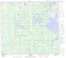
Maps showing Little Horse Creek, 79-12-W5, Alberta
Little Horse Creek is a River located in 79-12-W5, Alberta and has an elevation of 672 meters.
- Latitude: 55° 52' 44'' North (decimal: 55.8788888)
- Longitude: 115° 46' 50'' West (decimal: -115.7805555)
- Topography Feature Category: River
- Geographical Feature: Creek
- Canadian Province/Territory: Alberta
- Elevation: 672 meters
- Location: 79-12-W5
- Atlas of Canada Locator Map: Little Horse Creek
- GPS Coordinate Locator Map: Little Horse Creek Lat/Long
Little Horse Creek NTS Map Sheets