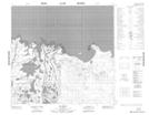
Maps showing Little Poplar Island, 111-4-W4, Alberta
Little Poplar Island is a Island located in 111-4-W4, Alberta.
- Latitude: 58° 39' 6'' North (decimal: 58.6516666)
- Longitude: 110° 37' 35'' West (decimal: -110.6263888)
- Topography Feature Category: Island
- Geographical Feature: Island
- Canadian Province/Territory: Alberta
- Location: 111-4-W4
- Atlas of Canada Locator Map: Little Poplar Island
- GPS Coordinate Locator Map: Little Poplar Island Lat/Long
Little Poplar Island NTS Map Sheets