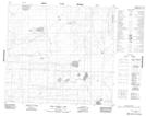
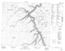
Maps showing Livock River, 11-86-18-W4, Alberta
Livock River is a River located in 11-86-18-W4, Alberta and has an elevation of 539 meters.
- Latitude: 56° 26' 12'' North (decimal: 56.4366666)
- Longitude: 112° 43' 5'' West (decimal: -112.7180555)
- Topography Feature Category: River
- Geographical Feature: River
- Canadian Province/Territory: Alberta
- Elevation: 539 meters
- Location: 11-86-18-W4
- Atlas of Canada Locator Map: Livock River
- GPS Coordinate Locator Map: Livock River Lat/Long
Livock River NTS Map Sheets