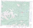
Maps showing Llama Flats, 56-10-W6, Alberta
Llama Flats is a Plain located in 56-10-W6, Alberta and has an elevation of 1863 meters.
- Latitude: 53° 49' 23'' North (decimal: 53.8230556)
- Longitude: 119° 29' 22'' West (decimal: -119.4894443)
- Topography Feature Category: Plain
- Geographical Feature: Flats
- Canadian Province/Territory: Alberta
- Elevation: 1863 meters
- Location: 56-10-W6
- Atlas of Canada Locator Map: Llama Flats
- GPS Coordinate Locator Map: Llama Flats Lat/Long
Llama Flats NTS Map Sheets