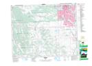
Maps showing Lloyd Lake, 13,14-22-2-W5, Alberta
Lloyd Lake is a Lake located in 13,14-22-2-W5, Alberta and has an elevation of 1140 meters.
- Latitude: 50° 52' 16'' North (decimal: 50.8711110)
- Longitude: 114° 9' 38'' West (decimal: -114.1605555)
- Topography Feature Category: Lake
- Geographical Feature: Lake
- Canadian Province/Territory: Alberta
- Elevation: 1140 meters
- Location: 13,14-22-2-W5
- Atlas of Canada Locator Map: Lloyd Lake
- GPS Coordinate Locator Map: Lloyd Lake Lat/Long
Lloyd Lake NTS Map Sheets