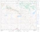
Maps showing Lloyds Hill, 22-37-6-W4, Alberta
Lloyds Hill is a Unincorporated area located in 22-37-6-W4, Alberta.
- Latitude: 52° 11' 26'' North (decimal: 52.1905555)
- Longitude: 110° 47' 8'' West (decimal: -110.7855555)
- Topography Feature Category: Unincorporated area
- Geographical Feature: Locality
- Canadian Province/Territory: Alberta
- Location: 22-37-6-W4
- Atlas of Canada Locator Map: Lloyds Hill
- GPS Coordinate Locator Map: Lloyds Hill Lat/Long
Lloyds Hill NTS Map Sheets