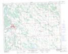
Maps showing Lodge, 24-39-7-W5, Alberta
Lodge is a Unincorporated area located in 24-39-7-W5, Alberta.
- Latitude: 52° 22' 17'' North (decimal: 52.3713889)
- Longitude: 114° 53' 4'' West (decimal: -114.8844443)
- Topography Feature Category: Unincorporated area
- Geographical Feature: Railway Point
- Canadian Province/Territory: Alberta
- Location: 24-39-7-W5
- Atlas of Canada Locator Map: Lodge
- GPS Coordinate Locator Map: Lodge Lat/Long
Lodge NTS Map Sheets