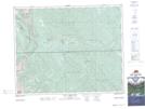
Maps showing Logan Creek, 31-9-W5, Alberta
Logan Creek is a River located in 31-9-W5, Alberta.
- Latitude: 51° 38' 51'' North (decimal: 51.6475000)
- Longitude: 115° 11' 44'' West (decimal: -115.1955555)
- Topography Feature Category: River
- Geographical Feature: Creek
- Canadian Province/Territory: Alberta
- Location: 31-9-W5
- Atlas of Canada Locator Map: Logan Creek
- GPS Coordinate Locator Map: Logan Creek Lat/Long
Logan Creek NTS Map Sheets