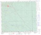
Maps showing Lois Lake, 66-9-W5, Alberta
Lois Lake is a Lake located in 66-9-W5, Alberta and has an elevation of 1088 meters.
- Latitude: 54° 42' 9'' North (decimal: 54.7024999)
- Longitude: 115° 18' 30'' West (decimal: -115.3083333)
- Topography Feature Category: Lake
- Geographical Feature: Lake
- Canadian Province/Territory: Alberta
- Elevation: 1088 meters
- Location: 66-9-W5
- Atlas of Canada Locator Map: Lois Lake
- GPS Coordinate Locator Map: Lois Lake Lat/Long
Lois Lake NTS Map Sheets