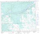
Maps showing Lombell, 5-59-9-W5, Alberta
Lombell is a Unincorporated area located in 5-59-9-W5, Alberta and has an elevation of 743 meters.
- Latitude: 54° 4' 41'' North (decimal: 54.0780555)
- Longitude: 115° 18' 16'' West (decimal: -115.3044443)
- Topography Feature Category: Unincorporated area
- Geographical Feature: Locality
- Canadian Province/Territory: Alberta
- Elevation: 743 meters
- Location: 5-59-9-W5
- Atlas of Canada Locator Map: Lombell
- GPS Coordinate Locator Map: Lombell Lat/Long
Lombell NTS Map Sheets