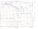
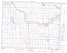
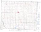
Maps showing Long Coulee, 32-14-22-W4, Alberta
Long Coulee is a Valley located in 32-14-22-W4, Alberta and has an elevation of 915 meters.
- Latitude: 50° 13' 18'' North (decimal: 50.2216666)
- Longitude: 112° 58' 13'' West (decimal: -112.9702777)
- Topography Feature Category: Valley
- Geographical Feature: Coulee
- Canadian Province/Territory: Alberta
- Elevation: 915 meters
- Location: 32-14-22-W4
- Atlas of Canada Locator Map: Long Coulee
- GPS Coordinate Locator Map: Long Coulee Lat/Long
Long Coulee NTS Map Sheets