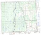
Maps showing Long End Lake, 64,65-3-W5, Alberta
Long End Lake is a Lake located in 64,65-3-W5, Alberta and has an elevation of 618 meters.
- Latitude: 54° 35' 25'' North (decimal: 54.5902777)
- Longitude: 114° 22' 52'' West (decimal: -114.3811110)
- Topography Feature Category: Lake
- Geographical Feature: Lake
- Canadian Province/Territory: Alberta
- Elevation: 618 meters
- Location: 64,65-3-W5
- Atlas of Canada Locator Map: Long End Lake
- GPS Coordinate Locator Map: Long End Lake Lat/Long
Long End Lake NTS Map Sheets