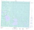
Maps showing Long Lake, 78-20-W4, Alberta
Long Lake is a Lake located in 78-20-W4, Alberta and has an elevation of 559 meters.
- Latitude: 55° 46' 32'' North (decimal: 55.7755555)
- Longitude: 113° 4' 37'' West (decimal: -113.0769443)
- Topography Feature Category: Lake
- Geographical Feature: Lake
- Canadian Province/Territory: Alberta
- Elevation: 559 meters
- Location: 78-20-W4
- Atlas of Canada Locator Map: Long Lake
- GPS Coordinate Locator Map: Long Lake Lat/Long
Long Lake NTS Map Sheets