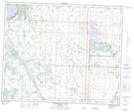
Maps showing Bearhills Lake, 45,46-25-W4, Alberta
Bearhills Lake is a Lake located in 45,46-25-W4, Alberta and has an elevation of 787 meters.
- Latitude: 52° 56' 19'' North (decimal: 52.9386110)
- Longitude: 113° 36' 50'' West (decimal: -113.6138889)
- Topography Feature Category: Lake
- Geographical Feature: Lake
- Canadian Province/Territory: Alberta
- Elevation: 787 meters
- Location: 45,46-25-W4
- Atlas of Canada Locator Map: Bearhills Lake
- GPS Coordinate Locator Map: Bearhills Lake Lat/Long
Bearhills Lake NTS Map Sheets