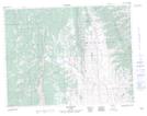
Maps showing Beaverdam Creek, 11-2-W5, Alberta
Beaverdam Creek is a River located in 11-2-W5, Alberta and has an elevation of 1552 meters.
- Latitude: 49° 53' 8'' North (decimal: 49.8855555)
- Longitude: 114° 15' 12'' West (decimal: -114.2533333)
- Topography Feature Category: River
- Geographical Feature: Creek
- Canadian Province/Territory: Alberta
- Elevation: 1552 meters
- Location: 11-2-W5
- Atlas of Canada Locator Map: Beaverdam Creek
- GPS Coordinate Locator Map: Beaverdam Creek Lat/Long