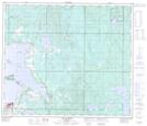
Maps showing Beaver Lake, 32-66-13-W4, Alberta
Beaver Lake is a Unincorporated area located in 32-66-13-W4, Alberta and has an elevation of 575 meters.
- Latitude: 54° 45' 37'' North (decimal: 54.7602777)
- Longitude: 111° 54' 35'' West (decimal: -111.9097221)
- Topography Feature Category: Unincorporated area
- Geographical Feature: Hamlet
- Canadian Province/Territory: Alberta
- Elevation: 575 meters
- Location: 32-66-13-W4
- Atlas of Canada Locator Map: Beaver Lake
- GPS Coordinate Locator Map: Beaver Lake Lat/Long
Beaver Lake NTS Map Sheets