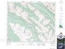
Maps showing Beaver Lake, 44,45-26,27-W5, Alberta
Beaver Lake is a Lake located in 44,45-26,27-W5, Alberta and has an elevation of 1563 meters.
- Latitude: 52° 52' 3'' North (decimal: 52.8675000)
- Longitude: 117° 43' 29'' West (decimal: -117.7247221)
- Topography Feature Category: Lake
- Geographical Feature: Lake
- Canadian Province/Territory: Alberta
- Elevation: 1563 meters
- Location: 44,45-26,27-W5
- Atlas of Canada Locator Map: Beaver Lake
- GPS Coordinate Locator Map: Beaver Lake Lat/Long
Beaver Lake NTS Map Sheets