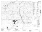
Maps showing Algar Lake, 84-15-W4, Alberta
Algar Lake is a Lake located in 84-15-W4, Alberta and has an elevation of 531 meters.
- Latitude: 56° 18' 42'' North (decimal: 56.3116667)
- Longitude: 112° 17' 32'' West (decimal: -112.2922222)
- Topography Feature Category: Lake
- Geographical Feature: Lake
- Canadian Province/Territory: Alberta
- Elevation: 531 meters
- Location: 84-15-W4
- Atlas of Canada Locator Map: Algar Lake
- GPS Coordinate Locator Map: Algar Lake Lat/Long
Algar Lake NTS Map Sheets