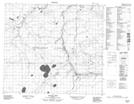
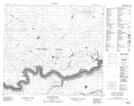
Maps showing Algar River, 17-87-14-W4, Alberta
Algar River is a River located in 17-87-14-W4, Alberta and has an elevation of 476 meters.
- Latitude: 56° 32' 55'' North (decimal: 56.5486111)
- Longitude: 112° 11' 39'' West (decimal: -112.1941666)
- Topography Feature Category: River
- Geographical Feature: River
- Canadian Province/Territory: Alberta
- Elevation: 476 meters
- Location: 17-87-14-W4
- Atlas of Canada Locator Map: Algar River
- GPS Coordinate Locator Map: Algar River Lat/Long
Algar River NTS Map Sheets