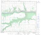
Maps showing Belloy Reservoir, 15-78-2-W6, Alberta
Belloy Reservoir is a Lake located in 15-78-2-W6, Alberta and has an elevation of 572 meters.
- Latitude: 55° 45' 19'' North (decimal: 55.7552778)
- Longitude: 118° 13' 11'' West (decimal: -118.2197221)
- Topography Feature Category: Lake
- Geographical Feature: Reservoir
- Canadian Province/Territory: Alberta
- Elevation: 572 meters
- Location: 15-78-2-W6
- Atlas of Canada Locator Map: Belloy Reservoir
- GPS Coordinate Locator Map: Belloy Reservoir Lat/Long
Belloy Reservoir NTS Map Sheets