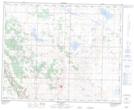
Maps showing Beltz Lake, 37-18,19-W4, Alberta
Beltz Lake is a Lake located in 37-18,19-W4, Alberta and has an elevation of 831 meters.
- Latitude: 52° 12' 35'' North (decimal: 52.2097222)
- Longitude: 112° 34' 45'' West (decimal: -112.5791667)
- Topography Feature Category: Lake
- Geographical Feature: Lake
- Canadian Province/Territory: Alberta
- Elevation: 831 meters
- Location: 37-18,19-W4
- Atlas of Canada Locator Map: Beltz Lake
- GPS Coordinate Locator Map: Beltz Lake Lat/Long
Beltz Lake NTS Map Sheets