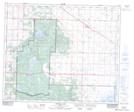
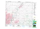
Maps showing Bennett Lake, 35-52-21-W4, Alberta
Bennett Lake is a Lake located in 35-52-21-W4, Alberta and has an elevation of 753 meters.
- Latitude: 53° 31' 48'' North (decimal: 53.5299999)
- Longitude: 112° 59' 30'' West (decimal: -112.9916667)
- Topography Feature Category: Lake
- Geographical Feature: Lake
- Canadian Province/Territory: Alberta
- Elevation: 753 meters
- Location: 35-52-21-W4
- Atlas of Canada Locator Map: Bennett Lake
- GPS Coordinate Locator Map: Bennett Lake Lat/Long
Bennett Lake NTS Map Sheets