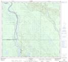
Maps showing Berdinskies, 23-104-9-W4, Alberta
Berdinskies is a Unincorporated area located in 23-104-9-W4, Alberta and has an elevation of 239 meters.
- Latitude: 58° 2' 47'' North (decimal: 58.0463889)
- Longitude: 111° 21' 39'' West (decimal: -111.3608332)
- Topography Feature Category: Unincorporated area
- Geographical Feature: Locality
- Canadian Province/Territory: Alberta
- Elevation: 239 meters
- Location: 23-104-9-W4
- Atlas of Canada Locator Map: Berdinskies
- GPS Coordinate Locator Map: Berdinskies Lat/Long
Berdinskies NTS Map Sheets