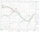
Maps showing Berkinshaw, 2-40-13-W4, Alberta
Berkinshaw is a Unincorporated area located in 2-40-13-W4, Alberta and has an elevation of 709 meters.
- Latitude: 52° 25' 3'' North (decimal: 52.4174999)
- Longitude: 111° 45' 38'' West (decimal: -111.7605555)
- Topography Feature Category: Unincorporated area
- Geographical Feature: Locality
- Canadian Province/Territory: Alberta
- Elevation: 709 meters
- Location: 2-40-13-W4
- Atlas of Canada Locator Map: Berkinshaw
- GPS Coordinate Locator Map: Berkinshaw Lat/Long
Berkinshaw NTS Map Sheets