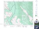
Maps showing Race Creek, 43-20-W5, Alberta
Race Creek is a River located in 43-20-W5, Alberta and has an elevation of 1540 meters.
- Latitude: 52° 42' 2'' North (decimal: 52.7005555)
- Longitude: 116° 48' 27'' West (decimal: -116.8074999)
- Topography Feature Category: River
- Geographical Feature: Creek
- Canadian Province/Territory: Alberta
- Elevation: 1540 meters
- Location: 43-20-W5
- Atlas of Canada Locator Map: Race Creek
- GPS Coordinate Locator Map: Race Creek Lat/Long
Race Creek NTS Map Sheets