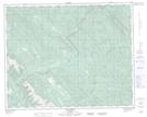
Maps showing Radiant Creek, 35-11-W5, Alberta
Radiant Creek is a River located in 35-11-W5, Alberta and has an elevation of 1562 meters.
- Latitude: 52° 2' 24'' North (decimal: 52.0399999)
- Longitude: 115° 32' 2'' West (decimal: -115.5338889)
- Topography Feature Category: River
- Geographical Feature: Creek
- Canadian Province/Territory: Alberta
- Elevation: 1562 meters
- Location: 35-11-W5
- Atlas of Canada Locator Map: Radiant Creek
- GPS Coordinate Locator Map: Radiant Creek Lat/Long
Radiant Creek NTS Map Sheets