Maps showing Ranch, 27-70-26-W4, Alberta
Ranch is a Unincorporated area located in 27-70-26-W4, Alberta and has an elevation of 623 meters.
- Latitude: 55° 5' 12'' North (decimal: 55.0866666)
- Longitude: 113° 52' 30'' West (decimal: -113.8749999)
- Topography Feature Category: Unincorporated area
- Geographical Feature: Locality
- Canadian Province/Territory: Alberta
- Elevation: 623 meters
- Location: 27-70-26-W4
- Atlas of Canada Locator Map: Ranch
- GPS Coordinate Locator Map: Ranch Lat/Long
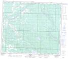
Ranch NTS Map Sheets