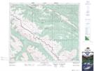
Maps showing Redcap Mountain, 46-22-W5, Alberta
Redcap Mountain is a Mountain located in 46-22-W5, Alberta and has an elevation of 2123 meters.
- Latitude: 52° 55' 54'' North (decimal: 52.9316666)
- Longitude: 117° 5' 6'' West (decimal: -117.0849999)
- Topography Feature Category: Mountain
- Geographical Feature: Mountain
- Canadian Province/Territory: Alberta
- Elevation: 2123 meters
- Location: 46-22-W5
- Atlas of Canada Locator Map: Redcap Mountain
- GPS Coordinate Locator Map: Redcap Mountain Lat/Long
Redcap Mountain NTS Map Sheets