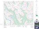
Maps showing Red Deer Lakes, 30-15-W5, Alberta
Red Deer Lakes is a Lake located in 30-15-W5, Alberta and has an elevation of 2156 meters.
- Latitude: 51° 32' 27'' North (decimal: 51.5408333)
- Longitude: 116° 2' 3'' West (decimal: -116.0341667)
- Topography Feature Category: Lake
- Geographical Feature: Lakes
- Canadian Province/Territory: Alberta
- Elevation: 2156 meters
- Location: 30-15-W5
- Atlas of Canada Locator Map: Red Deer Lakes
- GPS Coordinate Locator Map: Red Deer Lakes Lat/Long