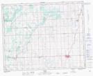
Maps showing Red Lodge, 20-34-2-W5, Alberta
Red Lodge is a Unincorporated area located in 20-34-2-W5, Alberta.
- Latitude: 51° 57' North (decimal: 51.9499999)
- Longitude: 114° 13' West (decimal: -114.2167000)
- Topography Feature Category: Unincorporated area
- Geographical Feature: Locality
- Canadian Province/Territory: Alberta
- Location: 20-34-2-W5
- GPS Coordinate Locator Map: Red Lodge Lat/Long