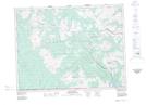
Maps showing Red Rock Canyon, 24-21-1-W5, Alberta
Red Rock Canyon is a Valley located in 24-21-1-W5, Alberta and has an elevation of 1613 meters.
- Latitude: 49° 8' 12'' North (decimal: 49.1366666)
- Longitude: 114° 1' 17'' West (decimal: -114.0213888)
- Topography Feature Category: Valley
- Geographical Feature: Canyon
- Canadian Province/Territory: Alberta
- Elevation: 1613 meters
- Location: 24-21-1-W5
- Atlas of Canada Locator Map: Red Rock Canyon
- GPS Coordinate Locator Map: Red Rock Canyon Lat/Long