Maps showing Mount Rhondda, 31-18-W5, Alberta
Mount Rhondda is a Mountain located in 31-18-W5, Alberta and has an elevation of 2853 meters.
- Latitude: 51° 38' 36'' North (decimal: 51.6433333)
- Longitude: 116° 33' 40'' West (decimal: -116.5611110)
- Topography Feature Category: Mountain
- Geographical Feature: Mount
- Canadian Province/Territory: Alberta
- Elevation: 2853 meters
- Location: 31-18-W5
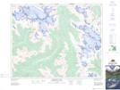
- Atlas of Canada Locator Map: Mount Rhondda
- GPS Coordinate Locator Map: Mount Rhondda Lat/Long
Mount Rhondda NTS Map Sheets