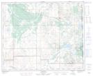
Maps showing Ribstone, 17-43-2-W4, Alberta
Ribstone is a Unincorporated area located in 17-43-2-W4, Alberta and has an elevation of 621 meters.
- Latitude: 52° 42' 25'' North (decimal: 52.7069444)
- Longitude: 110° 15' 52'' West (decimal: -110.2644443)
- Topography Feature Category: Unincorporated area
- Geographical Feature: Hamlet
- Canadian Province/Territory: Alberta
- Elevation: 621 meters
- Location: 17-43-2-W4
- Atlas of Canada Locator Map: Ribstone
- GPS Coordinate Locator Map: Ribstone Lat/Long