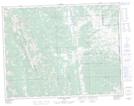
Maps showing Rickman Creek, 28-14-1-W5, Alberta
Rickman Creek is a River located in 28-14-1-W5, Alberta and has an elevation of 1336 meters.
- Latitude: 50° 12' 00'' North (decimal: 50.1999999)
- Longitude: 114° 5' 17'' West (decimal: -114.0880556)
- Topography Feature Category: River
- Geographical Feature: Creek
- Canadian Province/Territory: Alberta
- Elevation: 1336 meters
- Location: 28-14-1-W5
- Atlas of Canada Locator Map: Rickman Creek
- GPS Coordinate Locator Map: Rickman Creek Lat/Long
Rickman Creek NTS Map Sheets