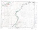
Maps showing Wild Turnip Hill, 8-24-W4, Alberta
Wild Turnip Hill is a Mountain located in 8-24-W4, Alberta and has an elevation of 1051 meters.
- Latitude: 49° 38' 28'' North (decimal: 49.6411111)
- Longitude: 113° 6' 45'' West (decimal: -113.1124999)
- Topography Feature Category: Mountain
- Geographical Feature: Hill
- Canadian Province/Territory: Alberta
- Elevation: 1051 meters
- Location: 8-24-W4
- Atlas of Canada Locator Map: Wild Turnip Hill
- GPS Coordinate Locator Map: Wild Turnip Hill Lat/Long
Wild Turnip Hill NTS Map Sheets