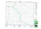
Maps showing Ferlow Junction, 6-46-20-W4, Alberta
Ferlow Junction is a Unincorporated area located in 6-46-20-W4, Alberta and has an elevation of 705 meters.
- Latitude: 52° 56' 40'' North (decimal: 52.9444444)
- Longitude: 112° 52' 53'' West (decimal: -112.8813888)
- Topography Feature Category: Unincorporated area
- Geographical Feature: Locality
- Canadian Province/Territory: Alberta
- Elevation: 705 meters
- Location: 6-46-20-W4
- Atlas of Canada Locator Map: Ferlow Junction
- GPS Coordinate Locator Map: Ferlow Junction Lat/Long