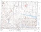
Maps showing Fifteen Mile Butte, 6-20-W4, Alberta
Fifteen Mile Butte is a Mountain located in 6-20-W4, Alberta and has an elevation of 946 meters.
- Latitude: 49° 29' 37'' North (decimal: 49.4936110)
- Longitude: 112° 40' 8'' West (decimal: -112.6688889)
- Topography Feature Category: Mountain
- Geographical Feature: Butte
- Canadian Province/Territory: Alberta
- Elevation: 946 meters
- Location: 6-20-W4
- Atlas of Canada Locator Map: Fifteen Mile Butte
- GPS Coordinate Locator Map: Fifteen Mile Butte Lat/Long