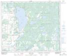
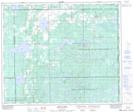
Maps showing Fishing Lake Metis Settlement, 57-2-W4, Alberta
Fishing Lake Metis Settlement is a Unincorporated area located in 57-2-W4, Alberta.
- Latitude: 54° 58' 57'' North (decimal: 54.9824999)
- Longitude: 110° 9' 16'' West (decimal: -110.1544443)
- Topography Feature Category: Unincorporated area
- Geographical Feature: Metis Settlement
- Canadian Province/Territory: Alberta
- Location: 57-2-W4
- Atlas of Canada Locator Map: Fishing Lake Metis Settlement
- GPS Coordinate Locator Map: Fishing Lake Metis Settlement Lat/Long
Fishing Lake Metis Settlement NTS Map Sheets